| Keelung River | |
|---|---|
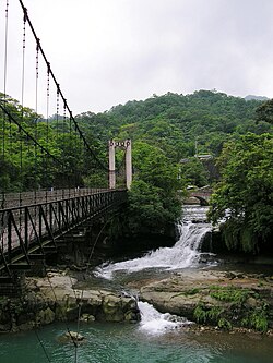
 Keelung River upstream | |
 | |
| Native name | 基隆河 (Chinese) |
| Location | |
| Country | Taiwan |
| Physical characteristics | |
| Source | |
| • location | Huo Shao Liao Mountain (火燒寮山) |
| • elevation | 560 m (1,840 ft) |
| Mouth | |
• location | Tamsui River |
• coordinates | 25°06′41″N 121°27′51″E / 25.1115°N 121.4643°E |
| Length | 86.4 km (53.7 mi)[1] |
| Basin size | 493 km2 (190 sq mi) |
 | |
The Keelung River (Chinese: 基隆河; pinyin: Jīlóng Hé; Wade–Giles: Chi1-lung2 Ho2; Pe̍h-ōe-jī: Ke-lâng-hô) is a river in northern Taiwan.
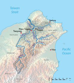
The Keelung River originates in the mountains west-northwest of the town of Jingtong in Pingxi District, New Taipei City, flows down to a rift valley and then flows ENE to Sandiaoling. Then it flows northward to a point between Jiufen and Keelung City, and then heads back in a general WSW direction to Taipei, where it joins the Tamsui River and flows out to sea. The land around the Keelung river was rich in gold and coal, and many areas were mined.[2]

- ^ "e河川知識服務網 名詞庫". e-river.wra.gov.tw. 經濟部水利署. Archived from the original on 29 September 2020. Retrieved 29 September 2020.
- ^ File:Keelung-Garnot-Kelung-1894.jpg