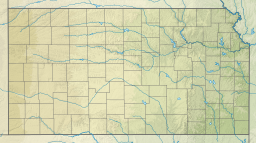
| Keith Sebelius Lake | |
|---|---|
 Aerial view of Keith Sebelius Lake | |
 | |
| Location | Norton County, Kansas |
| Coordinates | 39°48′15″N 99°55′55″W / 39.80417°N 99.93194°W |
| Type | Reservoir |
| Primary inflows | Prairie Dog Creek |
| Primary outflows | Prairie Dog Creek |
| Catchment area | 715 sq mi (1,850 km2)[1] |
| Basin countries | United States |
| Managing agency | U.S. Bureau of Reclamation |
| Built | December 1961 |
| First flooded | October 1964 |
| Max. length | 9.5 miles (15.3 km) |
| Surface area | 2,181 acres (8.83 km2) |
| Max. depth | 42 feet (13 m)[2] |
| Water volume | Full: 34,510 acre⋅ft (42,570,000 m3)[3] Current (Nov. 2015): 8,996 acre⋅ft (11,096,000 m3)[1] |
| Shore length1 | 32 miles (51 km) |
| Surface elevation | Full: 2,304 ft (702 m)[3] Current (Nov. 2015): 2,287 ft (697 m)[1] |
| Settlements | Norton |
| References | [1][4][5][6] |
| 1 Shore length is not a well-defined measure. | |
Keith Sebelius Lake, formerly known as Norton Reservoir, is a man-made reservoir on Prairie Dog Creek in northwest Kansas.[4][7] Built and managed by the U.S. Bureau of Reclamation, it is used for flood control, irrigation, recreation, and local water supply.[6] Prairie Dog State Park is located on its shore.[8]
- ^ a b c d "Current Reservoir Data for Keith Sebelius Lake". United States Bureau of Reclamation. Retrieved 2009-10-12.
- ^ "Keith Sebelius Fishing Information". Kansas Department of Wildlife, Parks and Tourism. Retrieved 2015-11-17.
- ^ a b "Keith Sebelius Lake (Norton Dam) Allocations" (PDF). U.S. Bureau of Reclamation. Retrieved 2015-11-17.
- ^ a b "Keith Sebelius Lake". Geographic Names Information System. United States Geological Survey, United States Department of the Interior. Retrieved 2015-10-20.
- ^ "Keith Sebelius". Kansas Department of Wildlife and Parks. Retrieved 2009-10-12..
- ^ a b "Almena Unit". U.S. Bureau of Reclamation. Retrieved 2015-10-20.
- ^ Cite error: The named reference
UPIwas invoked but never defined (see the help page). - ^ Cite error: The named reference
CountyMapwas invoked but never defined (see the help page).

