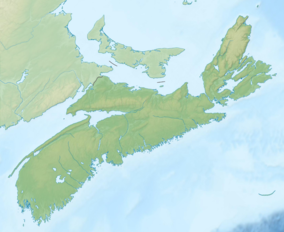
| Kejimkujik National Park | |
|---|---|
| Parc national Kejimkujik | |
 Little River | |
Location in Canada | |
| Location | Nova Scotia, Canada |
| Nearest city | Halifax |
| Coordinates | 44°23′57″N 65°13′06″W / 44.39917°N 65.21833°W |
| Area | 404 km2 (156 sq mi) |
| Established | 1967 |
| Visitors | 75,284 (in 2022–23[1]) |
| Governing body | Parks Canada |
 | |
| Official name | Kejimkujik National Historic Site of Canada |
| Designated | 1994 |
Kejimkujik National Park (/ˈkɛdʒɪməˌkuːdʒɪk/)[2] is a national park of Canada, covering 404 km2 (156 sq mi) in the southwest of Nova Scotia peninsula. Located within three municipalities, Annapolis, Queens, Digby, it consists of two separate land areas: an inland part, which is coincident with the Kejimkujik National Historic Site of Canada, and the Kejimkujik National Park Seaside on the Atlantic coast.[3]
The Historic site is a cultural landscape 404 square kilometres (156 sq mi) forested upland plain between the South Shore and the Annapolis Valley. It is home to petroglyph sites, habitation sites, fishing and hunting sites, travel routes and burial grounds, which attest to Mi’kmaq occupancy of this area for thousands of years.
The seaside part is a wilderness protection area featuring coastal bogs, beaches, intertidal areas, and abundant flora and fauna.[4]
The Royal Astronomical Society of Canada has designated the park a dark-sky preserve.[5]
The park is named after Kejimikujik Lake, the largest lake in the park.
- ^ Canada, Parks. "Parks Canada attendance 2022_23 - Parks Canada attendance 2022_23 - Open Government Portal". open.canada.ca. Retrieved 2024-05-07.
- ^ Parks Canada (2017-07-26). Parks Can Can Canada 2017. Archived from the original on 2021-12-12. Retrieved 2019-05-19.
- ^ Kejimkujik. Canadian Register of Historic Places. Retrieved 10 March 2013.
- ^ "Kejimkujik National Park and National Historic Site". Parks Canada. Retrieved 21 March 2019.
- ^ "N.S. national park named night sky preserve". CBC. Retrieved 22 March 2019.

