Native name: Pulau Kendi | |
|---|---|
 | |
 | |
| Geography | |
| Location | Strait of Malacca |
| Coordinates | 5°13′54.8898″N 100°10′35.4″E / 5.231913833°N 100.176500°E |
| Administration | |
| State | |
| City | |
| District | Southwest |
| Mukim | Bukit Pasir Panjang |
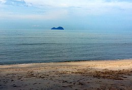
Kendi Island is an islet off the southwestern tip of Penang Island in the Malaysian state of Penang. Located over 3.4 km (2.1 miles) from Penang Island, this rocky, uninhabited islet is often frequented by anglers.[1] The terrain of much of the islet's shoreline is relatively jagged, except for a few narrow beaches.
- ^ "The islet few Penangites know - Views | The Star Online". www.thestar.com.my. Retrieved 7 August 2017.


