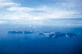
 Kent Group | |
Location of the Kent Group in Bass Strait | |
| Etymology | William Kent |
|---|---|
| Geography | |
| Location | Bass Strait |
| Coordinates | 39°27′36″S 147°19′48″E / 39.46000°S 147.33000°E |
| Total islands | 6 |
| Major islands | Deal Island |
| Area | 1,576 ha (3,890 acres)[1] |
| Administration | |
| State | Tasmania |

The Kent Group are a grouping of six granite islands located in Bass Strait, north-west of the Furneaux Group in Tasmania, Australia.[2] Collectively, the group is comprised within the Kent Group National Park.[1]
The islands were named Kent's Group by Matthew Flinders, "in honour of my friend captain William Kent, then commander of Supply" when Flinders passed them on 8 February 1798 in Francis (on her way to salvage Sydney Cove).[3] The largest island in the group is Deal Island; the others, in order of descending size, are Erith Island, Dover Island, North East Isle, South West Isle and Judgement Rocks.
- ^ a b "Kent Group National Park". Tasmania Parks and Wildlife Service. Tasmanian Government.
- ^ "Kent Group (TAS)". Gazetteer of Australia online. Geoscience Australia, Australian Government.
- ^ Flinders, Matthew (1814), A Voyage to Terra Australis, London: G. and W. Nicol, entry for 8 February 1798
