| Keonjhar State କେନ୍ଦୁଝର | |||||||
|---|---|---|---|---|---|---|---|
| Princely State of British India | |||||||
| 12th century–1948 | |||||||
|
Flag | |||||||
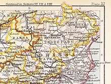
 Keonjhar State in the Imperial Gazetteer of India | |||||||
| Area | |||||||
• 1931 | 8,019 km2 (3,096 sq mi) | ||||||
| Population | |||||||
• 1931 | 460,609 | ||||||
| History | |||||||
• Established | 12th century | ||||||
| 1948 | |||||||
| |||||||
Keonjhar State (Odia: କେନ୍ଦୁଝର), also known as Keunjhar, was one of the princely states of India during the period of the British Raj.[1] The second largest of the states of the Orissa States Agency, it was located in present-day Kendujhar district, Odisha.

The state was bounded in the north by Singhbhum District, in the east by the State of Mayurbhanj and Balasore District, in the south by Dhenkanal State and Cuttack District, and in the west by the states of Pal Lahara and Bonai. The state consisted of two clearly differentiated areas: Low Keonjhar, a region of flat river valleys — the main river being the Baitarani, and the High Keonjhar, an area of forests dominated by mountain ranges with the Gandhamadan reaching a height of 1078 m. The capital was at Keonjhar. [2]
- ^ Chisholm, Hugh, ed. (1911). . Encyclopædia Britannica. Vol. 15 (11th ed.). Cambridge University Press. p. 749.
- ^ Imperial Gazetteer of India, v. 15, p. 202
