| Kettle River Recreation Area | |
|---|---|
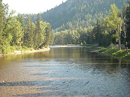
 Looking south from the KVR Bridge | |
| Location | Kootenay Boundary, British Columbia |
| Nearest city | Osoyoos |
| Coordinates | 49°06′27″N 118°59′14″W / 49.1075°N 118.9873°W |
| Area | 179 ha (440 acres) |
| Designation | Recreation Area |
| Created | 6 July 1972 |
| Governing body | BC Parks |
| Website | bcparks |
Kettle River Recreation Area is a 179 hectare provincial recreation area located inside a sharp S-bend of the Kettle River approximately 6 kilometres north of the community of Rock Creek, British Columbia.[2] It is one of only two recreation areas in British Columbia, the other being Coquihalla Summit Recreation Area.
- ^ "Kettle River Recreation Area". Protected Planet. Retrieved September 15, 2020.
- ^ "Kettle River Recreation Area - BC Parks". bcparks.ca. BC Ministry of the Environment. Retrieved September 6, 2020.
