| Kew Melbourne, Victoria | |||||||||||||||
|---|---|---|---|---|---|---|---|---|---|---|---|---|---|---|---|
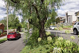
 Kellett Grove, Kew | |||||||||||||||
 | |||||||||||||||
| Coordinates | 37°48′19″S 145°2′9″E / 37.80528°S 145.03583°E | ||||||||||||||
| Population | 24,499 (SAL 2021)[1] | ||||||||||||||
| Postcode(s) | 3101 | ||||||||||||||
| Elevation | 58 m (190 ft) | ||||||||||||||
| Area | 10.5 km2 (4.1 sq mi) | ||||||||||||||
| Location | 6 km (4 mi) from Melbourne | ||||||||||||||
| LGA(s) | City of Boroondara | ||||||||||||||
| State electorate(s) | Kew | ||||||||||||||
| Federal division(s) | Kooyong | ||||||||||||||
| |||||||||||||||
Kew (/kjuː/) is a suburb of Melbourne, Victoria, Australia, found 5 km east from Melbourne's Central Business District. Kew is located within the City of Boroondara local government area. Kew recorded a population of 24,499 at the 2021 census.[2]
A city in its own right from 1860 to 1994, Kew was amalgamated with the cities of Hawthorn and Camberwell to form the City of Boroondara. The suburb borders the Yarra River to the west and northwest, with Kew East to the northeast, Hawthorn and Hawthorn East to its south, and with Balwyn, Balwyn North and Deepdene to the east.
- ^ Australian Bureau of Statistics (28 June 2022). "Kew (Vic.) (suburb and locality)". Australian Census 2021 QuickStats. Retrieved 28 June 2022.
- ^ Australian Bureau of Statistics (28 June 2022). "Kew (Vic.) (Suburbs and Localities)". 2021 Census QuickStats. Retrieved 3 July 2022.
