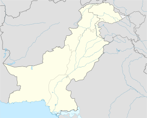
Khaplu
خپلو ཁཔ་ལུ། | |
|---|---|
City administered by Pakistan | |
| Nickname: Shyok valley | |
| Coordinates: 35°10′N 76°20′E / 35.167°N 76.333°E | |
| Administering country | Pakistan |
| Autonomous territory | Gilgit Baltistan |
| Baltistan division | Ghanche |
| Government | |
| • Deputy Commissioner | Adeel Haider Baryar (PAS) |
| Elevation | 8,500 ft (2,600 m) |
| Population | |
| • Total | 175,000 |
| Time zone | UTC+5 (PST) |
| • Summer (DST) | UTC+6 (GMT+6) |
| Website | Khaplu Valley, Skardu |
Khaplu (Urdu: خپلو, pronounced: [xəpluː]; Balti: ཁཔ་ལུ།), also spelt Khapalu,[1] is a city that serves as the administrative capital of the Ghanche District in Pakistan-administered Gilgit-Baltistan, within the disputed Kashmir region.[2] Located 103 km (64 mi) east of Skardu, Khaplu was historically the second-largest kingdom in Baltistan under the Yabgo dynasty and played a key role in guarding the trade route to Ladakh along the Shyok River, near its confluence with the Indus.
Khaplu is a popular base for trekking into the Hushe Valley, which provides access to the high peaks of Masherbrum, K6, K7, and Chogolisa. The city is home to the 700-year-old mosque, Chaqchan Mosque, founded by Ameer Kabeer Syed Ali Hamadani (RA). Other notable tourist sites include Ehlie Broq, Hanjor, Thoqsi Khar, Kaldaq, and the Shyok River.


