Khumbu Pasanglhamu
खुम्बु पासाङल्हामु गाउँपालिका | |
|---|---|
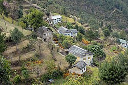
 A small settlement near Kharikhola, Khumbu Pasanglhamu | |
| Coordinates (Chaurikharka): 27°44′N 86°44′E / 27.74°N 86.73°E | |
| Country | |
| Province | Province No. 1 |
| District | Solukhumbu District |
| Wards | 5 |
| Established | 12 March 2017 |
| Government | |
| • Type | Rural council |
| • Body | Executive office of Khumbu Pasanglhamu Rural Municipality |
| • Chairperson | Mr. Mingma Chhiri Sherpa |
| • Vice-chairperson | Mrs.Tasilhamu Sherpa (NCP) |
| • Chief Administrative Officer | Mr.Mohan Prasad Chapagain |
| Area | |
| • Total | 1,539.11 km2 (594.25 sq mi) |
| • Rank | 5th (Nepal) |
| Highest elevation | 8,848 m (29,029 ft) |
| Lowest elevation | 1,900 m (6,200 ft) |
| Population | |
| • Total | 8,989 |
| • Density | 5.8/km2 (15/sq mi) |
| Time zone | UTC+5:45 (Nepal Time) |
| Area code | +977-38 |
| HQ | Office of Chaurikharka |
| Website | Official website |
Khumbu Pasanglhamu (Nepali: खुम्बु पासाङल्हामु गाउँपालिका) is one of 7 rural municipalities (Gaunpalika) in Solukhumbu district of Province No. 1 of Nepal.[1] Khumjung, Namche & Jubing (1,5,7–9 No. Wards of Jubing) and Chaurikharka were incorporated while creating it. It has the total population of 9,133 according to the 2011 Nepal census and area of 1,539.11 square kilometres (594.25 sq mi).[2] The admin centre of this gaunpalika is that of the Chaurikharka.[3]
Previously, Khumjung, Namche, Jubing and Chaurikharka were all separate local level body (Village development committee) of Solukhumbu District. Solukhumbu was a district out of six districts of Sagarmatha Zone. Sagarmatha was a zone (division) of Eastern development region of Nepal.
- ^ "List of Local bodies of Nepal". MoFALD. Retrieved 2 June 2017.
- ^ "Khumbu Pasanglahmu Rural municipality in Nepal". www.citypopulation.de. 8 October 2017. Retrieved 12 March 2018.
- ^ "744 new local units come into effect". The Kathmandu Post. Retrieved 15 March 2017.

