Kigoma Region
Mkoa wa Kigoma (Swahili) | |
|---|---|
|
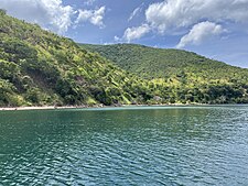
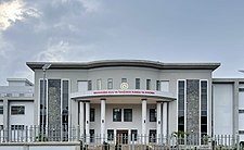
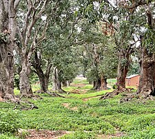
From top to bottom: Lake Tanganyika in Kagongo Ward, Kigoma District, Kigoma High Court and Mango row in historic Ujiji | |
| Nickname: Tanzania's Sunset Region | |
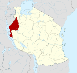
 Location in Tanzania | |
| Coordinates: 4°52′56.64″S 29°39′41.4″E / 4.8824000°S 29.661500°E | |
| Country | |
| Zone | Western |
| Named for | Kigoma |
| Capital | Kigoma |
| Districts | |
| Government | |
| • Regional Commissioner | Thobias Andengenye |
| Area | |
• Total | 37,040 km2 (14,300 sq mi) |
| • Rank | 8th of 31 |
| Highest elevation (Kicherere) | 1,917 m (6,289 ft) |
| Population (2022)[1] | |
• Total | 2,470,967 |
| • Rank | 10th of 31 |
| • Density | 67/km2 (170/sq mi) |
| Demonym | Kigoman |
| Ethnic groups | |
| • Settler | Swahili, Arab, Congolese & Burundians |
| • Native | Ha, Vinza, Tongwe, Jiji & Holoholo |
| Time zone | UTC+3 (EAT) |
| Postcode | 47xxx |
| Area code | 028 |
| ISO 3166 code | TZ-05[2] |
| HDI (2021) | 0.520[3] low · 19th of 25 |
| Website | Official website |
| Symbols of Tanzania | |
| Bird |  |
| Butterfly | |
| Fish | |
| Mammal |  |
| Tree |  |
| Mineral | |
Kigoma Region (Mkoa wa Kigoma in Swahili) is one of Tanzania's 31 administrative regions, with the city of Kigoma as the reigonal capital. Kigoma Region borders Kagera Region, Geita Region, Katavi Region, Tabora Region, DRC and Burundi According to the 2012 national census, the region had a population of 2,127,930, which was higher than the pre-census projection of 1,971,332.[4]: page 2 For 2002–2012, the region's 2.4 percent average annual population growth rate was tied for the fourteenth highest in the country.[4]: page 4 It was also the sixteenth most densely populated region with 57 people per square kilometer.[4]: page 6 With a size of 45,066 square kilometres (17,400 sq mi),[5] the region is slightly smaller than Estonia (45,227 square kilometres (17,462 sq mi)).
- ^ Cite error: The named reference
2022_censuswas invoked but never defined (see the help page). - ^ "IS0 3166". ISO. Retrieved 2022-10-09.
- ^ "Sub-national HDI - Area Database - Global Data Lab". hdi.globaldatalab.org. Archived from the original on 2018-09-23. Retrieved 2020-02-26.
- ^ a b c Population Distribution by Administrative Units, United Republic of Tanzania, 2013 Archived 2013-06-12 at the Wayback Machine
- ^ Statistical Abstract 2011, Tanzania National Bureau of Statistics Archived 2013-11-05 at the Wayback Machine


