| Kilmashogue | |
|---|---|
| Cill Mochióg | |
 Kilmashogue Mountain viewed from the southeast | |
| Highest point | |
| Elevation | 408 m (1,339 ft)[1] |
| Coordinates | 53°15′2.01″N 6°16′2.03″W / 53.2505583°N 6.2672306°W[1] |
| Geography | |
| Location | Dún Laoghaire–Rathdown, Ireland |
| Parent range | Dublin Mountains |
| OSI/OSNI grid | O157236 |
| Topo map | OSI Discovery #50 |
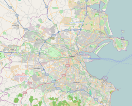
Kilmashogue or Kilmashoge (Irish: Cill Mochióg)[2] is a mountain in Dún Laoghaire–Rathdown county in Ireland. It is 408 metres (1,339 feet) high[1] and forms part of the group of hills in the Dublin Mountains which comprises Two Rock, Three Rock, Kilmashogue and Tibradden Mountains.[3] The forest plantation on its northern slope, which is composed mainly of Sitka spruce, Scots pine and beech, is a habitat for Sika deer, hares, rabbits and foxes.[4] A number of prehistoric monuments can be found on the slopes of the mountain.
Coillte, the state-owned enterprise that manages the forestry on the mountain's slopes, suggest that the name Kilmashogue is a corruption of coill na fumsaoige, which means "wood of the ash", or coill na fuiseoige, which means "wood of the lark".[4]
- ^ a b c Discovery Series No. 50 (Map). Ordnance Survey Ireland.
- ^ "Kilmashogue". Placenames Database of Ireland. Department of Culture, Heritage and the Gaeltacht. Retrieved 8 August 2010.
- ^ Healy, p. 105.
- ^ a b "Kilmashogue". Coillte Outdoors. Retrieved 16 August 2010.

