| King's Norton and Northfield | |
|---|---|
 King's Norton Union Workhouse Many meetings of both the KN RDC and the KN&N UDC were held at the Union Workhouse buildings in Selly Oak | |
| Population | |
| • 1901 | 57,122 |
| • 1911 | 81,153 |
| History | |
| • Origin | Rural Sanitary District (1875-1894) |
| • Created | 1894 |
| • Abolished | 1911 |
| • Succeeded by | County Borough of Birmingham[1] Bromsgrove Rural District[2] Halesowen Rural District[3] |
| Status | Rural District (1894-1898) Urban District (1898-1911) |
| Government | Rural District Council (1894-1898) Urban District Council (1898-1911) |
| • HQ | Clerk's Office at 10 Newhall Street, Birmingham[4] |
 King's Norton & Northfield UDC Seal | |
| Subdivisions | |
| • Type | Civil Parishes |
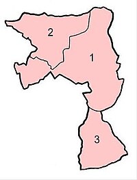
| • Units |
|
 | |
King's Norton and Northfield Urban District was a local government administrative district in north Worcestershire, England, from 1898 until 1911.[5] Much of its area was afterwards absorbed into the neighbouring Borough of Birmingham, under the Greater Birmingham Scheme, and now constitutes most of the city's southern and southwestern suburban environs.[6]
- ^ The County Borough of Birmingham took over the governance of that part of the civil parish of King's Norton comprising the wards of King's Norton, Moseley (Moor Green), Moseley (Wake Green), King's Heath (East), King's Heath (West), Stirchley (North), Stirchley (South), and most of the Rednal and Rubery ward; as well as nearly all of the civil parish of Northfield, comprising the wards of Northfield, Selly Oak (East), Selly Oak (West), and the greater part of the Bartley Green ward.
- ^ Bromsgrove Rural District assumed responsibility for the new civil parish of Wythall, comprising the former Wythall ward of King's Norton Parish, as well as the civil parish and ward of Beoley. As the civil parish of Cofton Hackett was already within this district, it also succeeded in that part of Rednal transferred to that parish from the Rednal and Rubery ward of the King's Norton parish.
- ^ Halesowen Rural District succeeded only in that area of the Bartley Green ward of Northfield parish that had been transferred to Illey civil parish, which was already part of the district.
- ^ This was the address of the offices of Mr Edwin Docker, Solicitor and Clerk to the Council.
- ^ Youngs (1991), Local Administrative Units, Vol. II, p. 763.
- ^ Those parts of the former Urban District of King's Norton and Northfield taken into Birmingham are now represented by the City's modern residential suburban districts of Bartley Green, Bournbrook, Bournville, Brandwood End, California, Cotteridge, Druid's Heath, Hawkesley, Highter's Heath, King's Heath, King's Norton, Kitwell, Lifford, Longbridge, Moor Green, Moseley, Northfield, Rednal (part of), Rubery (part of), Selly Oak, Selly Park, Shenley, Stirchley, Ten Acres, Turves Green, Wake Green (part of), Warstock, Weoley Castle, Weoley Hill, West Heath, and Woodgate.