| King George VI Reservoir | |
|---|---|
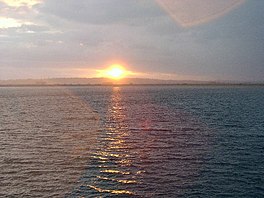
 View across the reservoir | |
| Location | Surrey since 1965; Middlesex before 1965 |
| Coordinates | 51°26′56″N 0°30′07″W / 51.449°N 0.502°W |
| Type | Man made reservoir |
| Primary inflows | Staines Reservoirs Aqueduct from Hythe End |
| Primary outflows | Staines Reservoirs Aqueduct to Kempton Park and Hampton Waterworks |
| Catchment area | Thames Basin |
| Basin countries | United Kingdom |
| Built | 1937 |
| Surface area | 140 ha (350 acres) |
| Max. depth | 17 m (56 ft) |
| Water volume | 15.88 Gl (3.49×10⁹ imp gal) |
| Shore length1 | 5.23 kilometres (3.25 mi) |
| Surface elevation | 15 metres (49 ft) to 16 metres (52 ft) |
| Islands | None |
| 1 Shore length is not a well-defined measure. | |
The King George VI Reservoir sits between Stanwell Moor and Staines upon Thames, south-west of Heathrow, England. It is between Staines Moor and a north–south road abutting the Staines Reservoirs. The reservoir was opened in November 1947 and named after the then reigning monarch George VI. It is owned by Thames Water.
