King Mswati III International Airport | |||||||||||
|---|---|---|---|---|---|---|---|---|---|---|---|
 | |||||||||||
| Summary | |||||||||||
| Airport type | Public | ||||||||||
| Operator | Eswatini Civil Aviation Authority (ESWACAA) | ||||||||||
| Location | Lubombo, Eswatini | ||||||||||
| Elevation AMSL | 1,070 ft / 326 m | ||||||||||
| Coordinates | 26°21′24″S 031°43′01″E / 26.35667°S 31.71694°E | ||||||||||
| Website | eswacaa.co.sz/airports/kingmswatiIII/ | ||||||||||
| Map | |||||||||||
 | |||||||||||
| Runways | |||||||||||
| |||||||||||
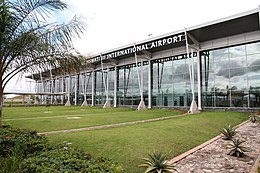
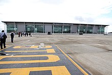
King Mswati III International Airport (IATA: SHO, ICAO: FDSK), initially named Sikhuphe International Airport in the planning and construction phase,[4] is an airport in Eswatini.[5] It replaced Matsapha Airport in 2014 as the only international airport in Eswatini that caters to commercial flights. It is designed to handle 360,000 passengers per year.


- ^ Airport information for FDMS[usurped] from DAFIF (effective October 2013)
- ^ Airport information for SHO at Great Circle Mapper. Source: DAFIF (effective October 2006).
- ^ Google Earth - Sikhupe
- ^ "Swaziland king opens 'white elephant' airport". www.news24.com.ng. News24 Nigeria. 8 March 2014. Archived from the original on 21 March 2014. Retrieved 15 July 2014.
Swaziland's ruler, however, defended the airport, which was built under the name Sikhuphe International Airport but was on Friday renamed King Mswati-III International Airport.
- ^ "Sikhuphe to receive the world early next year". Retrieved 15 August 2010.
