Kingston, New York | |
|---|---|
| City of Kingston | |
Stockade District with the Old Dutch Church visible in the background | |
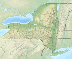
 Location in Ulster County and the state of New York. | |
| Coordinates: 41°55′43″N 74°00′07″W / 41.92861°N 74.00194°W | |
| Country | United States |
| State | New York |
| County | Ulster |
| Settled | 1652 |
| Village | April 6, 1805 |
| City | May 29, 1872 |
| Government | |
| • Mayor | Steve Noble (D) |
| • Common Council | Members' List |
| Area | |
| • City | 8.77 sq mi (22.71 km2) |
| • Land | 7.48 sq mi (19.38 km2) |
| • Water | 1.29 sq mi (3.33 km2) |
| Elevation | 191 ft (58 m) |
| Population (2020) | |
| • City | 24,069 |
| • Density | 3,216.92/sq mi (1,242.00/km2) |
| • Metro | 177,749 |
| Time zone | UTC−5 (Eastern (EST)) |
| • Summer (DST) | UTC−4 (EDT) |
| ZIP Codes | 12401–12402 |
| Area code | 845 |
| FIPS code | 36-39727 |
| GNIS feature ID | 0979119 |
| Website | kingston-ny |
Kingston is the only city in, and the county seat of, Ulster County, New York, United States. It is 91 miles (146 km) north of New York City and 59 miles (95 km) south of Albany. The city's metropolitan area is grouped with the New York metropolitan area around Manhattan by the United States Census Bureau.[2] The population was 24,069 at the 2020 United States Census.[3]
Kingston became New York's first capital in 1777. During the American Revolutionary War, the city was burned by the British on October 13, 1777, after the Battles of Saratoga. In the 19th century, it became an important transport hub after the discovery of natural cement in the region. It had connections to other markets through both the railroad and canal connections.
Many of the older buildings are considered contributing as part of three historic districts, including the Stockade District uptown, the Midtown Neighborhood Broadway Corridor, and the Rondout-West Strand Historic District downtown. Each district is listed on the National Register of Historic Places.
- ^ "ArcGIS REST Services Directory". United States Census Bureau. Retrieved September 20, 2022.
- ^ New York-Newark, NY-NJ-CT-PA Combined Statistical Area Archived 2014-12-29 at the Wayback Machine, United States Census Bureau. Accessed December 28, 2014.
- ^ "Census - Geography Profile: Kingston city, New York". United States Census Bureau. Retrieved January 11, 2022.


