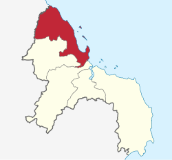
Kinondoni District
Halimashauri ya Manispaa ya Kinondoni (Swahili) | |
|---|---|
|
From top to bottom: Bagamoyo Road in Mwananyamala ward, Tanzanite Bridge connecting Kinondoni District's Msasani ward with Kivukoni ward in Ilala District & Kunduchi Ruins | |
| Nickname: The cultural district | |
 Kinondoni District in Dar | |
| Coordinates: 6°42′19.08″S 39°6′45.72″E / 6.7053000°S 39.1127000°E | |
| Country | |
| Region | Dar es Salaam Region |
| District | 2000 |
| Named for | Kinondoni village |
| Capital | Ndugumbi |
| Area | |
| • Total | 269.5 km2 (104.1 sq mi) |
| • Rank | 3rd in Dar |
| Highest elevation | 290 m (950 ft) |
| Population (2022 census)[1] | |
| • Total | 982,328 |
| • Rank | 4th in Dar |
| • Density | 3,600/km2 (9,400/sq mi) |
| Demonym | Kinondonian |
| Ethnic groups | |
| • Settler | Swahili |
| • Native | Zaramo |
| Time zone | UTC+3 (EAT) |
| Tanzanian Postcode | 141 |
| Website | Official website |
| Symbols of Tanzania | |
| Bird |  |
| Fish | |
| Mammal | Rondo dwarf galago |
Kinondoni District, officially the Kinondoni Municipal Council (Halimashauri ya Manispaa ya Kinondoni, in Swahili) is one of five districts of the Dar es Salaam Region of Tanzania. The district is bordered to the north by Bagamoyo District and Kibaha of Pwani Region, to the east by the Indian Ocean, the west by Ubungo District, and to the south by the Ilala District. The district covers an area of 269.5 km2 (104.1 sq mi).[2] The district is comparable in size to the land area of Malta.[3] The administrative seat is Ndugumbi. The district is home to one of the best preserved Medieval Swahili settlements, Kunduchi Ruins, headquarters for the National Muslim Council of Tanzania (BAKWATA) and Makumbusho Village Museum. Considered the cultural center of Dar es Salaam, Kinondoni District is also regarded the birthplace of the musical genre of Singeli. In addition the district is one of two districts in Dar es Salaam that has a National Historic Site, namely the Kunduchi Ruins. The 2012 National Tanzania Census states the population for Kinondoni as 1,775,049.[4]
- ^ Citypopulation.de Population of Kinondoni Municipality
- ^ "Tanzania: Coastal Zone(Districts and Wards) - Population Statistics, Charts, and Map".
- ^ 316 km2 (122 sq mi) for Malta at "Area size comparison". Nation master. 2022. Retrieved 17 May 2023.
- ^ "2012 Population and Housing Census General Report" (PDF). Government of Tanzania. Retrieved 2021-11-19.


