Kintamani
ᬓᬶᬦ᭄ᬢᬫᬦᬶ | |
|---|---|
 Mount Batur seen from Kintamani | |
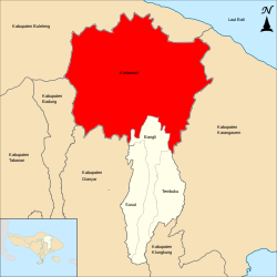
 Location with Bali province | |
| Coordinates: 8°15′29″S 115°19′43″E / 8.25806°S 115.32861°E | |
| Country | Indonesia |
| Province | Bali |
| Regency | Bangli |
| Area | |
| • Total | 141.7 sq mi (366.9 km2) |
| • Density | 794/sq mi (306.5/km2) |
| Demographics | |
| • Ethnic groups | Balinese Bali Aga |
| • Religion | Hinduism (Balinese Hinduism • folk Hinduism) |
| • Languages |
|
| Time zone | Indonesia Central Time |
Kintamani (Balinese: ᬓᬶᬦ᭄ᬢᬫᬦᬶ, Kintámani) is a district (kecamatan), and a village within that district, on the western edge of the larger caldera wall of the Mount Batur (Gunung Batur) caldera in Bali, Indonesia. It is on the same north–south road as Penelokan and has been used as a stopping place to view the Mount Batur region. Kintamani is also known for Pura Tuluk Biyu's 1,000-year-old "Rites of Peace" stone tablets and the Kintamani dog breed.[2] It is situated next to Mount Batur.[3][4] Kintamani many inhabited by native Balinese people, Bali Aga.

Kintamani District covers a greater land area than the city of Denpasar at 366.9 km2, and it was home to 112,463 people at the 2020 Census,[5] but the area is rural, with only 7,402 people in 2010 in the administrative village of 19.45 km2 which has grown along the single main road. Altogether there are 48 villages (desa) in the district.
The Kintamani district includes 19 Bali Aga villages, disseminated at the foot of mount Batur, along lake Batur and in the valleys.[6]
- ^ Badan Pusat Statistik, Jakarta, 2021.
- ^ "Bali's Highly Regarded Breed of Kintamani Dog Gaining International Popularity". Archived from the original on 2017-11-01. Retrieved 2014-07-29.
- ^ "The Official Website of Indonesia Tourism - Indonesia Travel".
- ^ "Kintamani Bali". 5 May 2020.
- ^ Badan Pusat Statistik, Jakarta, 2021.
- ^ Yudantini, Ni Made (2020). "Bali Aga Villages in Kintamani, Inventory of Tangible and Intangible Aspects". Advances in Engineering Research. 192 (EduARCHsia & Senvar 2019 International Conference (EduARCHsia 2019)): 160–165. Retrieved 2024-05-09.