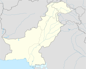
| Kirana Hills Site | |
|---|---|
Kirana | |
| Part of PAF Base Mushaf | |
| Sargodha District in Punjab, Pakistan Near Sargodha, Punjab in Pakistan | |
 The summit of Kirana Hills. | |
| Coordinates | 31°58′15″N 72°45′26″E / 31.97083°N 72.75722°E |
| Type | Radar and Weapons Complex |
| Area | 100 sq mi (260 km2)[1] |
| Height | 1,050 ft (320 m)[2] |
| Length | 12 mi (19 km)[1] |
| Site information | |
| Owner | Ministry of Defense |
| Operator | National Defence Complex (Main contractor) |
| Controlled by | |
| Open to the public | Yes |
| Status | Active |
| Defining authority | Geological Survey of Pakistan (GSP) |
| Site history | |
| Built | 1979 |
| Built by | Pakistan Army Corps of Engineers |
| In use | 1981–95 |
| Garrison information | |
| Garrison | No. 4091 Squadron |
| Test information | |
| Subcritical tests | 24 under Kirana-I |
| Remediation | 1995 |
The Kirana Hills Site[4] is an extensive rocky mountain range and a reservation of the Ministry of Defense (MoD) located in the Sargodha District in Punjab, Pakistan.[4][5][6][7]
Known locally as "Black Mountains"[8] due to its brownish landscape, it is expanded between the township of Rabwah and the metropolitan city of Sargodha.[9]
The highest peak of the Kirana Hills are measured at the 1,050 ft (320 m)[2] with average peaks at highest peak is about 600 feet (180 m).[10]
- ^ a b East Pakistan Geographical Society 1964, p. 28.
- ^ a b Geological Survey 1913, p. 230.
- ^ Shaikh 2000, p. 310.
- ^ a b Bhat (retd), Col Vinayak (22 November 2017). "Pakistan is protecting its nuclear missiles by building underground fortresses". ThePrint. Retrieved 19 February 2024.
- ^ Mahajan 2009, pp. 100–110
- ^ Ali 2002, pp. 25–26
- ^ Smith 2007, pp. 92–93
- ^ DoE&ES 2012, p. 33
- ^ Wikimaps. "Kirana Hills". Wikimaps. Retrieved 14 June 2015.
- ^ DoE&ES 2012, pp. 4–5
