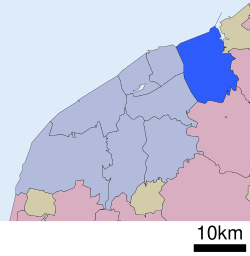
Kita-ku
北区 | |
|---|---|
| Kita Ward | |
 Fukushimagata Lagoon Park | |
 Location of Kita-ku in Niigata city | |
| Coordinates: 37°54′58.5″N 139°13′6.9″E / 37.916250°N 139.218583°E | |
| Country | Japan |
| Region | Kōshin'etsu, Hokuriku (Chūbu) |
| Prefecture | Niigata |
| City | Niigata |
| Area | |
| • Total | 107.72 km2 (41.59 sq mi) |
| Population (September 1, 2016) | |
| • Total | 74,559 |
| • Density | 690/km2 (1,800/sq mi) |
| Time zone | UTC+9 (Japan Standard Time) |
| Address | 3197 Kuzutsuka, Kita-ku, Niigata-shi, Niigata 950-3393 |
| Phone number | 025-387-1000 |
| Website | Official website |

Kita-ku (北区, Kita-ku) is one of the eight wards of Niigata City, Niigata Prefecture, in the Hokuriku region of Japan. As of 1 September 2018[update], the ward had an estimated population of 74,559 in households [1] and a population density of 690 persons per km². The total area of the ward was 107.72 square kilometres (41.59 sq mi).
- ^ Niigata city official statistics(in Japanese)
