This article needs additional citations for verification. (May 2013) |
Kitadaito Airport 北大東空港 Kitadaitō Kūkō | |||||||||||
|---|---|---|---|---|---|---|---|---|---|---|---|
 | |||||||||||
| Summary | |||||||||||
| Airport type | Public | ||||||||||
| Operator | Okinawa Prefecture | ||||||||||
| Location | Kitadaitō, Japan | ||||||||||
| Elevation AMSL | 71 ft / 22 m | ||||||||||
| Coordinates | 25°56′41″N 131°19′37″E / 25.94472°N 131.32694°E | ||||||||||
| Map | |||||||||||
 | |||||||||||
| Runways | |||||||||||
| |||||||||||
| Statistics (2015) | |||||||||||
| |||||||||||
Source: Japanese Ministry of Land, Infrastructure, Transport and Tourism[1] | |||||||||||
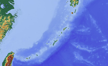
Kitadaitō Airport (北大東空港, Kitadaitō Kūkō, (IATA: KTD, ICAO: RORK)) is located on the island of Kitadaitōjima in the village of Kitadaitō, Shimajiri District, Okinawa Prefecture, Japan.
The prefecture operates the airport, which is classified as a third class airport.
Only a round flight from Naha, to Kitadaitō and Minami Daito Airport, back to Naha is operated every day. The route differs on the day of the week. Flight from Kitadaitō to Minamidaitō is the shortest flight in Japan, costs JPY¥7,600, and is only 12 km (7.5 mi) long, takes 3 minutes in the air. This flight will end on 31 July 2024.[2]
- ^ "Kita Daito Airport" (PDF). Japanese Ministry of Land, Infrastructure, Transport and Tourism. Archived from the original (PDF) on 21 October 2016. Retrieved 7 January 2017.
- ^ "JAL Group Discontinues Shortest Domestic Japan Route in 3Q24". Aeroroutes. Retrieved 31 January 2024.

