Klepp Municipality
Klepp kommune | |
|---|---|
| Klep herred (historic name) | |
 View of the Orrestranda beach along the Klepp coast | |
|
| |
 Rogaland within Norway | |
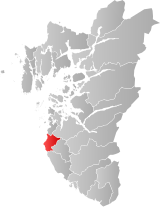
 Klepp within Rogaland | |
| Coordinates: 58°46′38″N 05°35′48″E / 58.77722°N 5.59667°E | |
| Country | Norway |
| County | Rogaland |
| District | Jæren |
| Established | 1 Jan 1838 |
| • Created as | Formannskapsdistrikt |
| Administrative centre | Kleppe |
| Government | |
| • Mayor (2023) | Kjetil Maudal (FrP) |
| Area | |
| • Total | 113.49 km2 (43.82 sq mi) |
| • Land | 102.36 km2 (39.52 sq mi) |
| • Water | 11.13 km2 (4.30 sq mi) 9.8% |
| • Rank | #324 in Norway |
| Population (2023) | |
| • Total | 20,615 |
| • Rank | #62 in Norway |
| • Density | 201.4/km2 (522/sq mi) |
| • Change (10 years) | |
| Demonym | Kleppsbu[1] |
| Official language | |
| • Norwegian form | Nynorsk |
| Time zone | UTC+01:00 (CET) |
| • Summer (DST) | UTC+02:00 (CEST) |
| ISO 3166 code | NO-1120[3] |
| Website | Official website |
Klepp is a municipality in Rogaland county, Norway. It is located in the traditional district of Jæren. The administrative centre of the municipality is the village of Kleppe. Other villages in Klepp include Klepp stasjon, Orre, Orstad, Pollestad, Verdalen, and Voll.[4] Klepp is a flat and open agricultural landscape. The highest point, Tinghaug, is at 102 metres (335 ft) above sea level. There are long stretches of sand beaches along the North Sea coastline in the west.[4]
The 113-square-kilometre (44 sq mi) municipality is the 324th largest by area out of the 356 municipalities in Norway. Klepp is the 63rd most populous municipality in Norway with a population of 20,615. The municipality's population density is 201.4 inhabitants per square kilometre (522/sq mi) and its population has increased by 13.1% over the previous 10-year period.[5][6] The population around Kleppe is growing rapidly, mostly in the form of suburban single-family homes, but also in the form of some apartment blocks. There is a shopping mall in Kleppe called Jærhagen.
- ^ "Navn på steder og personer: Innbyggjarnamn" (in Norwegian). Språkrådet.
- ^ "Forskrift om målvedtak i kommunar og fylkeskommunar" (in Norwegian). Lovdata.no.
- ^ Bolstad, Erik; Thorsnæs, Geir, eds. (26 January 2023). "Kommunenummer". Store norske leksikon (in Norwegian). Kunnskapsforlaget.
- ^ a b Store norske leksikon. "Klepp" (in Norwegian). Retrieved 31 May 2016.
- ^ Statistisk sentralbyrå. "Table: 06913: Population 1 January and population changes during the calendar year (M)" (in Norwegian).
- ^ Statistisk sentralbyrå. "09280: Area of land and fresh water (km²) (M)" (in Norwegian).

