| Kohala | |
|---|---|
 Kohala volcano as seen from Mauna Kea | |
| Highest point | |
| Elevation | 5,480 ft (1,670 m)[1] |
| Prominence | 2,600 ft (790 m)[2] |
| Coordinates | 20°05′10″N 155°43′02″W / 20.08611°N 155.71722°W[1] |
| Naming | |
| Language of name | Hawaiian |
| Pronunciation | Hawaiian pronunciation: [koˈhɐlə] |
| Geography | |
Hawaii, U.S. | |
| Parent range | Hawaiian Islands |
| Topo map | USGS Kamuela |
| Geology | |
| Rock age | >1,000,000 years |
| Mountain type(s) | Shield volcano, Hotspot volcano[1] |
| Volcanic arc/belt | Hawaiian-Emperor seamount chain |
| Last eruption | About 120,000 years ago[1] |
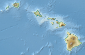
Kohala is the oldest of five volcanoes that make up the island of Hawaii. Kohala is an estimated one million years old—so old that it experienced, and recorded, the reversal of Earth's magnetic field 780,000 years ago. It is believed to have breached sea level more than 500,000 years ago[1] and to have last erupted 120,000 years ago. Kohala is 606 km2 (234 sq mi) in area and 14,000 km3 (3,400 cu mi) in volume, and thus constitutes just under 6% of the island of Hawaii.[1]
Kohala is a shield volcano cut by multiple deep gorges, which are the product of thousands of years of erosion. Unlike the typical symmetry of other Hawaiian volcanoes, Kohala is shaped like a foot. Toward the end of its shield-building stage 250,000 to 300,000 years ago, a landslide destroyed the northeast flank of the volcano, reducing its height by over 1,000 m (3,300 ft) and traveling 130 km (81 mi) across the sea floor. This huge landslide may be partially responsible for the volcano's foot-like shape.[3] Marine fossils have been found on the flank of the volcano, far too high to have been deposited by standard ocean waves. Analysis indicated that the fossils had been deposited by a massive tsunami approximately 120,000 years ago.
Because it is so far from the nearest major landmass, the ecosystem of Kohala has experienced geographic isolation, resulting in a unique ecosystem. There are several initiatives to preserve this ecosystem against invasive species. [citation needed] Crops, especially sweet potato (Ipomoea batatas), have been cultivated on the Leeward side of the volcano for centuries. The northern part of the island is named after the mountain, with two districts named North and South Kohala. King Kamehameha I, the first King of the Kingdom of Hawaii, was born in North Kohala, near Hawi.
- ^ a b c d e f "Kohala - Hawai'i's Oldest Volcano". Hawaiian Volcano Observatory. United States Geological Survey. 1998-03-20. Retrieved 2008-08-22.
- ^ "Kohala, Hawaii". Peakbagger: Kaunu o Kaleioohie. peakbagger.com. Retrieved 17 February 2015.
- ^ Cite error: The named reference
USGS-2007was invoked but never defined (see the help page).
