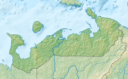
Native name: о́стров Колгу́ев | |
|---|---|
 Kolguyev Island. 1963 U.S. Army map section | |
| Geography | |
| Location | Arctic Sea |
| Coordinates | 69°05′N 49°15′E / 69.083°N 49.250°E |
| Area | 3,497 km2 (1,350 sq mi) |
| Highest elevation | 166 m (545 ft) |
| Highest point | Gora Paarkov-Sarlopy |
| Administration | |
Russia | |
| Oblast | Arkhangelsk Oblast |
| Okrug | Nenets Autonomous Okrug |
| Largest settlement | Bugrino (pop. 210) |
| Demographics | |
| Population | 413 (2021) |
| Ethnic groups | Nenets, Russians, Komi |
Kolguyev Island (Russian: о́стров Колгу́ев) is an island in Nenets Autonomous Okrug of Russia, located in the south-eastern Barents Sea (west of the Pechora Sea) to the north-east of the Kanin Peninsula.[1]
- ^ GoogleEarth - Location
