| Korkodon Коркодон / Коркигэ | |
|---|---|
 | |
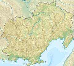
Mouth location in Magadan Oblast, Russia | |
| Location | |
| Country | Magadan Oblast, Russia |
| Physical characteristics | |
| Source | |
| • location | Korkodon Range Kolyma Mountains |
| • coordinates | 63°11′48″N 157°34′51″E / 63.19667°N 157.58083°E |
| Mouth | Kolyma |
• coordinates | 64°43′50″N 153°58′22″E / 64.73056°N 153.97278°E |
• elevation | 93 m (305 ft) |
| Length | 476 km (296 mi) |
| Basin size | 42,800 km2 (16,500 sq mi) |
| Discharge | |
| • average | 51.3 m3/s (1,810 cu ft/s) |
| Basin features | |
| Progression | Kolyma→ East Siberian Sea |
The Korkodon (Russian: Коркодон; Northern Yukaghir: Коркигэ) is a river in Magadan Oblast, Russian Far East. It is a right tributary of the Kolyma, with a length of 476 kilometres (296 mi) a drainage basin of 42,800 square kilometres (16,500 sq mi).[1] The upper reaches of the river are in Omsukchansky District, then it flows across the Srednekansky District in its lower course.[2][3] The name of the river originated in the Northern Yukaghir language.[4]
The Korkodon basin is a desolate area; there are no settlements, but since the lower reaches of the river are navigable; timber rafting was carried out in the 20th century.[5]
- ^ "Река Коркодон in the State Water Register of Russia". textual.ru (in Russian).
- ^ Google Earth
- ^ "Топографска карта Q-55 56; M 1:1 000 000 - Topographic USSR Chart (in Russian)". Retrieved 6 January 2022.
- ^ Поспелов Е. М. (1998). Географические названия мира: Топонимический словарь (3000 экз ed.). М. Р. А. Агеева: Русские словари. p. 215. ISBN 5-89216-029-7.
- ^ Cite error: The named reference
WRwas invoked but never defined (see the help page).
