Krakolye
Краколье | |
|---|---|
Village (abolished) | |
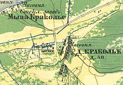
 Map. 1860 year | |
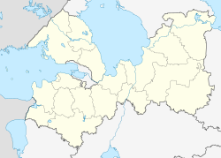
| Coordinates: 59°39′N 28°17′E / 59.650°N 28.283°E | |
| Country | Russia |
| Federal subject | Leningrad Oblast |
| Administrative district | Kingiseppsky District |
| Selsoviet | Ust-Luzhsky Selsoviet |
| First mentioned | 1654 |
| Abolished | October 24, 2008[1] |
| Elevation | 13 m (43 ft) |
| Population | |
• Estimate (2007)[2] | 110 |
Preview warning: Page using Template:Infobox Russian inhabited locality with unknown parameter "date"

Krakolye (Russian: Кракóлье; Votic: Jõgõperä; Finnish: Joenperä; Ingrian: Joenperä) was a rural locality (a village) in Ust-Luzhsky Selsoviet of Kingiseppsky District in Leningrad Oblast, Russia, located just south of Ust-Luga and about 8 kilometers (5.0 mi) southwest of the Ust-Luga Harbour. It is now a part of the settlement of Ust-Luga.[1] Population: 110 (2007 est.).[2]


