| Ku-ring-gai Council New South Wales | |||||||||||||||
|---|---|---|---|---|---|---|---|---|---|---|---|---|---|---|---|
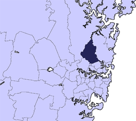
 Location in Metropolitan Sydney | |||||||||||||||
 | |||||||||||||||
| Coordinates | 33°45′15″S 151°09′06″E / 33.75417°S 151.15167°E | ||||||||||||||
| Population | 124,076 (2021 census)[1] | ||||||||||||||
| • Density | 1,443/km2 (3,737/sq mi) | ||||||||||||||
| Established |
| ||||||||||||||
| Area | 86 km2 (33.2 sq mi) | ||||||||||||||
| Mayor | Sam Ngai | ||||||||||||||
| Council seat | Gordon | ||||||||||||||
| Region | Metropolitan Sydney | ||||||||||||||
| State electorate(s) | |||||||||||||||
| Federal division(s) | Bradfield (limited parts of Wahroonga to be moved to Berowra at next election) | ||||||||||||||
 | |||||||||||||||
| Website | Ku-ring-gai Council | ||||||||||||||
| |||||||||||||||
Ku-ring-gai Council is a local government area in Northern Sydney (Upper North Shore), in the state of New South Wales, Australia. The area is named after a fictional Aboriginal language group.[2][3][4]
Major transport routes through the area include the Pacific Highway and North Shore railway line. Because of its good soils and elevated position as part of the Hornsby Plateau, Ku-ring-gai was originally covered by a large area of dry sclerophyll forest, parts of which still remain and form a component of the Ku-ring-gai Chase National Park. There are also many domestic gardens in the residential parts of Ku-ring-gai.
The mayor of Ku-ring-gai Council is Sam Ngai, an independent politician, elected on 19 September 2023.[5]
The council comprises an area of 86 square kilometres (33 sq mi), and as at the 2021 census, had an estimated population of 124,076. Ku-ring-gai is the most advantaged area in Australia to live in, at the top of the Index of Relative Socio-economic Advantage and Disadvantage (IRSAD).[6]
- ^ Australian Bureau of Statistics (28 June 2022). "Ku-ring-gai". 2021 Census QuickStats. Retrieved 29 January 2024.
- ^ Attenbrow, Val (2002). Sydney's Aboriginal past: investigating the archaeological and historical records. Sydney: UNSW Press. pp. 22–35. ISBN 9781742231167.
- ^ Filling A Void: A review of the historical context for the use of the word 'Guringai'. Sydney: Aboriginal Heritage Office. 2015.
- ^ John, Morecombe (20 February 2015). "Misunderstanding: The historical fiction of the word Guringai that has filled a void in our knowledge of the original inhabitants". Manly Daily. Retrieved 23 September 2021.
- ^ "Results of Ku-ring-gai mayoral election". Ku-ring-gai Living. 21 September 2023. Archived from the original on 29 January 2024. Retrieved 29 January 2024.
- ^ Gladstone, Nigel (27 March 2018). "Sydney's latte line exposes a city divided". The Sydney Morning Herald. Retrieved 28 March 2018.