| Kuban River | |
|---|---|
 | |
 | |
| Location | |
| Location | Eastern Europe |
| Country | |
| Federal subjects |
|
| Physical characteristics | |
| Source | |
| • location | Main Caucasian Range Russia |
| • elevation | 3,400 m (11,200 ft) |
| Mouth | Sea of Azov |
• coordinates | 45°20′N 37°24′E / 45.333°N 37.400°E |
• elevation | 0 m (0 ft) |
| Length | 870 km (540 mi) |
| Basin size | 57,900 km2 (22,400 sq mi) |
| Discharge | |
| • average | 425 m3/s (15,000 cu ft/s) (maximum near Krasnodar) |
| Basin features | |
| Tributaries | |
| • left | Urup, Laba, Belaya |
| Official name | Kuban Delta: Group of limans between Kuban & Protoka Rivers |
| Designated | 13 September 1994 |
| Reference no. | 674[1] |
| Official name | Kuban Delta: Akhtaro-Grivenskaya group of limans |
| Designated | 13 September 1994 |
| Reference no. | 675[2] |
 | |
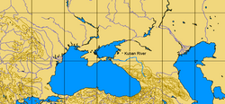
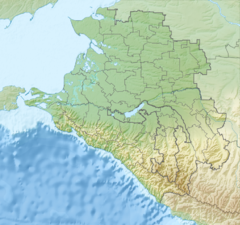
The Kuban[a] is a river in Russia that flows through the Western Caucasus and drains into the Sea of Azov. The Kuban runs mostly through Krasnodar Krai for 660 kilometres (410 mi), but also in the Karachay–Cherkess Republic, Stavropol Krai and the Republic of Adygea.
The Kuban flows 870 kilometres (540 mi) north and west from its source near Mount Elbrus in the Caucasus Mountains, eventually reaching Temryuk Bay in the Sea of Azov. It is navigable up to Krasnodar. Major cities on the river are Karachayevsk, Cherkessk, Nevinnomyssk, Armavir, Novokubansk, Kropotkin, Ust-Labinsk, Krasnodar and Temryuk. Despite its name, Slavyansk-on-Kuban lies not on the Kuban River, but on its distributary the Protoka.
- ^ "Kuban Delta: Group of limans between Kuban & Protoka Rivers". Ramsar Sites Information Service. Retrieved 25 April 2018.
- ^ "Kuban Delta: Akhtaro-Grivenskaya group of limans". Ramsar Sites Information Service. Retrieved 25 April 2018.
Cite error: There are <ref group=lower-alpha> tags or {{efn}} templates on this page, but the references will not show without a {{reflist|group=lower-alpha}} template or {{notelist}} template (see the help page).


