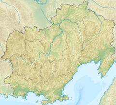
| Kulu Кулу | |
|---|---|
 The Kulu and the Ayan-Yuryakh are located at the head of the Kolyma | |
Mouth location in Magadan Oblast, Russia | |
| Physical characteristics | |
| Source | Confluence of rivers Khujakh and Kenelichi |
| • location | Suntar-Khayata, Khabarovsk Krai |
| • coordinates | 61°52′23″N 144°33′40″E / 61.87306°N 144.56111°E[1] |
| Mouth | Kolyma river |
• location | Tenkinsky District, Magadan Oblast, Russia |
• coordinates | 62°17′40″N 147°43′55″E / 62.29444°N 147.73194°E |
| Length | 300 kilometres (190 mi)[2] |
| Basin size | 15,600 square kilometres (6,000 sq mi)[2] |
| Discharge | |
| • average | 140 m3/s (4,900 cu ft/s) |
| Basin features | |
| Progression | Kolyma→ East Siberian Sea |
The Kulu (Russian: Кулу) is a river in Khabarovsk Krai and Magadan Oblast, Russia. It is a right tributary of the Kolyma river, which forms at the confluence of the Kulu and the Ayan-Yuryakh.[1]
The name of the river originated in the Chukchi word kuul — meaning "deep river".[3]
The Kulu flows through desolate territory; the only settlement by the river is Kulu, a village which had a population of 1,345 inhabitants in 1977, but which was abolished in 2008. In 2017 it was revived by two families who resettled the abandoned village and established a farm. There were 56 inhabitants in 2021.[4]
- ^ a b "Кулу" [Ayan-Yuryakh]. Вода Россия [Water Russia] (in Russian). Retrieved 4 January 2022.
- ^ a b "Река Кулу". Государственный Водный Реестр [State Water Register] (in Russian). Retrieved 4 January 2022.
- ^ Leontyev V.V. , Novikova K.A. Toponymic Dictionary of the North-East of the USSR / Scientific ed. G. A. Menovschikov ; FEB AN USSR . North-East complex. Research institute for Archeology, History and Ethnography. - Magadan: Magad. Prince Publishing House , 1989 . P. 213. - ISBN 5-7581-0044-7
- ^ В Магаданской области возрождаются населенные пункты благодаря программе «дальневосточный гектар»
