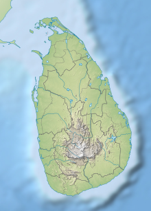
| Kumana National Park | |
|---|---|
 Kudumbigala Sanctuary in Kumana National Park | |
| Location | Eastern Province, Sri Lanka |
| Nearest city | Hambantota |
| Coordinates | 6°30′47″N 81°41′16″E / 6.51306°N 81.68778°E |
| Area | 35,664 hectares (88,130 acres) |
| Established | 20 January 1970 |
| Governing body | Department of Wildlife Conservation |
| Official name | Kumana Wetland Cluster |
| Designated | 29 October 2010 |
| Reference no. | 1931[1] |
Kumana National Park in Sri Lanka is renowned for its avifauna, particularly its large flocks of migratory waterfowl and wading birds. The park is 391 kilometres (243 mi) southeast of Colombo on Sri Lanka's southeastern coast.[2] Kumana is contiguous with Yala National Park.[3] Kumana was formerly known as Yala East National Park, but changed to its present name on 5 September 2006.[4]
The park was closed from 1985 to March 2003 because of the LTTE (Liberation Tigers of Tamil Elam) attacks. It was also affected by the Boxing Day tsunami in 2004.[5]
- ^ "Kumana Wetland Cluster". Ramsar Sites Information Service. Retrieved 5 April 2020.
- ^ de Livera, Lankika (14 August 2005). "Wild at its wildest". The Sunday Times. Retrieved 16 June 2009.
- ^ "Yala East National Park". iwmi.org. International Water Management Institute. 2006. Archived from the original on 7 October 2011. Retrieved 16 June 2009.
- ^ Mendis, Risidra (18 October 2006). "Yala East becomes Kumana National Park". The Morning Leader. Archived from the original on 2 March 2008. Retrieved 16 June 2009.
- ^ Kariyawasam, Dayananda (3 March 2005). "Major plan under way to restore Lanka's natural ecosystems". Daily News. Archived from the original on 10 October 2012. Retrieved 16 June 2009.
