Kurigram
কুড়িগ্রাম | |
|---|---|
| Kurigram District | |
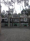
Clockwise from top: Jamuna River, Ulipur Munshibari, Mekurtari Shahi Mosque at Rajarhat Upazila, Dharla Bridge | |
 Location of Kurigram District in Bangladesh | |
 Expandable map of Kurigram District | |
| Coordinates: 25°45′N 89°40′E / 25.75°N 89.66°E | |
| Country | |
| Division | Rangpur Division |
| Headquarters | Kurigram |
| Government | |
| • Deputy Commissioner | Md Rezaul Karim[1] |
| Area | |
| • Total | 2,245.04 km2 (866.81 sq mi) |
| Population | |
| • Total | 2,329,160 |
| • Density | 1,000/km2 (2,700/sq mi) |
| Time zone | UTC+06:00 (BST) |
| Postal code | 5600 |
| Area code | 0581 |
| ISO 3166 code | BD-28 |
| HDI (2018) | 0.591[3] medium · 15th of 21 |
| Website | kurigram |
Kurigram District (Bengali: কুড়িগ্রাম) is a district of Bangladesh in the Rangpur Division. The district is located in northern Bangladesh along the country's border with India.[4] Under British rule, the area was organized as a mahakuma and was not established as a district until 1984.
- ^ "List of Deputy Commissioners". Pmis.mopa.gov.bd. Retrieved 2022-03-29.
- ^ Cite error: The named reference
2022census-prelimwas invoked but never defined (see the help page). - ^ "Sub-national HDI - Area Database - Global Data Lab". hdi.globaldatalab.org. Retrieved 2020-03-18.
- ^ Md Kamal Hossain (2012). "Kurigram District". In Sirajul Islam and Ahmed A. Jamal (ed.). Banglapedia: National Encyclopedia of Bangladesh (Second ed.). Asiatic Society of Bangladesh.


