Kwigillingok
Kuigilnguq | |
|---|---|
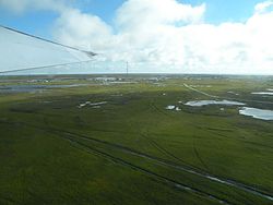
 Aerial view of Kwigillingok | |
 Location of Kwigillingok, Alaska | |
| Coordinates: 59°52′20″N 163°9′58″W / 59.87222°N 163.16611°W | |
| Country | United States |
| State | Alaska |
| Census Area | Bethel |
| Government | |
| • State senator | Lyman Hoffman (D) |
| • State rep. | Conrad McCormick (D) |
| Area | |
| • Total | 23.83 sq mi (61.71 km2) |
| • Land | 23.79 sq mi (61.62 km2) |
| • Water | 0.04 sq mi (0.09 km2) |
| Population (2020) | |
| • Total | 380 |
| • Density | 15.97/sq mi (6.17/km2) |
| Time zone | UTC-9 (Alaska (AKST)) |
| • Summer (DST) | UTC-8 (AKDT) |
| ZIP codes | 99622 |
| Area code | 907 |
| FIPS code | 02-42490 |
Kwigillingok (Central Yupik: Kuigilnguq) is a census-designated place (CDP) in Bethel Census Area, Alaska, United States. The population was 321 at the 2010 census, down from 338 in 2000.
- ^ "2020 U.S. Gazetteer Files". United States Census Bureau. Retrieved October 29, 2021.