| La Bocayna | |
|---|---|
| Estrecho de la Bocayna (Spanish) | |
 | |
| Location | Between Lanzarote and Fuerteventura |
| Coordinates | 28°48′00″N 13°48′00″W / 28.80000°N 13.80000°W |
| Type | Strait |
| Ocean/sea sources | Atlantic Ocean |
| Basin countries | Spain |
| Min. width | 11 km (6.8 mi; 5.9 nmi) |
| Islands | Lobos Island |
| Settlements | Corralejo and Playa Blanca |
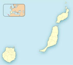
La Bocayna or La Bocaina (Spanish: Estrecho de la Bocaina) is a sea strait that separates Lanzarote from Fuerteventura in the Canary Islands. The island of Lobos is situated on the southern side of the strait, close to Fuerteventura.[1][2]
In the 19th century, the strait was known as a safe anchorage with a sandy bottom, which shelved gradually towards Lanzarote with depths of up to five fathoms. The shore around Lobos was less hospitable, being ‘foul and rocky’. A steady trade wind could be found in the strait, although it was blocked by the hills of Lanzarote, becalming ships that were in their lee, tacking towards Lobos was needed to regain the wind.[3]
Large breakers were observed by one ship’s captain, produced by a heavy westerly swell. Waves up to 18 metres (60 ft) high were seen breaking on the northern point of Lobos, the sound of the waves could be heard up to six or seven leagues away.[3]

