La Grange
French Bar | |
|---|---|
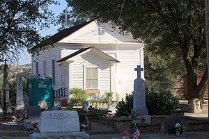
 Stage stop in La Grange Historic District. | |
| Coordinates: 37°39′49″N 120°27′49″W / 37.66361°N 120.46361°W | |
| Country | United States |
| State | California |
| County | Stanislaus County |
| Area | |
| • Total | 0.093 sq mi (0.24 km2) |
| • Land | 0.093 sq mi (0.24 km2) |
| • Water | 0 sq mi (0 km2) |
| Elevation | 259 ft (79 m) |
| Population (2020) | |
| • Total | 166 |
| • Density | 1,800/sq mi (690/km2) |
| Time zone | UTC-8 (Pacific) |
| • Summer (DST) | UTC-7 (PDT) |
| GNIS feature ID | 226726[2] |
| Reference no. | 414 |


La Grange is a small unincorporated community and census-designated place (CDP) in rural Stanislaus County, California. Its altitude is 259 feet (76 m). As of 2020 it has a population of 166. It is located along the Tuolumne River, and is near the La Grange Dam and the New Don Pedro Dam.