Lahaul and Spiti district | |
|---|---|
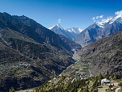
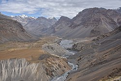
Bhaga valley in Lahaul (top); Spiti valley near Losar (bottom) | |
 Location in Himachal Pradesh | |
| Coordinates (Keylong): 32°30′N 77°36′E / 32.500°N 77.600°E | |
| Country | |
| State | |
| Headquarters | Keylong |
| Government | |
| • Vidhan Sabha constituencies | 01 |
| Area | |
| • Total | 13,833 km2 (5,341 sq mi) |
| Population (2011) | |
| • Total | 31,564 |
| • Density | 2.3/km2 (5.9/sq mi) |
| • Urban | None |
| Demographics | |
| • Literacy | 86.97% (male), 66.5% (female) |
| • Sex ratio | 916 |
| Time zone | UTC+05:30 (IST) |
| Vehicle registration | HP-41, HP-42, HP-43 |
| Major highways | one (Manali-Leh National Highway) |
| Average annual precipitation | Scanty rainfall |
| Website | https://hplahaulspiti.gov.in |
The Lahaul and Spiti district in the Indian state of Himachal Pradesh consists of the two formerly separate districts of Lahaul (Tibetan: གར་ཞ་, Wylie: gar zha) and Spiti (Tibetan: སྤི་ཏི་, Wylie: spi ti; or Tibetan: སྤྱི་ཏི, Wylie: spyi ti). The present administrative center is Kyelang in Lahaul. Before the two districts were merged, Kardang was the capital of Lahaul, and Dhankar the capital of Spiti. The district was formed in 1960 and is the fourth least populous district in India (out of 640).[1] It is the least densely populated district of India, according to the Census of India 2011.
- ^ "District Census Handbook: Lahaul and Spiti" (PDF). censusindia.gov.in. Registrar General and Census Commissioner of India. 2011.


