Lai-Hka
လၢႆးၶႃႈ၊ ၸႄႈဝဵင်း လဲချားမြို့နယ် Lecha | |
|---|---|
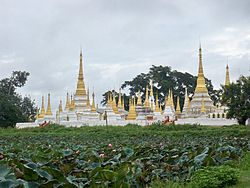
 Pawrana Saeditaw Buddhist temple | |
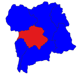
 Location in Loilem district | |
| Coordinates: 21°16′20″N 97°39′10″E / 21.27222°N 97.65278°E | |
| Country | |
| State | Shan State |
| Shan | [Lai-Hka District] |
| Elevation | 971 m (3,186 ft) |
| Time zone | UTC+6.30 (MST) |
Lai-Hka Township (Shan: ဝဵင်းလၢႆးၶႃႈ), also known as Legya Township (Burmese: လဲချားမြို့နယ်), is the former capital of Laihka State, one of the former southern Shan States. The city has a population of over 60,000. It lays 3,116 feet (950 m) above sea level on the eastern border of Kesee and Nam Zang. In the south, it connects Panglong and Lui Lin. Its neighboring towns are Lokjok to the west and Merng Klueng to the north. The total area of Lai-Hka Township is 914.92 square miles (2,369.6 km2) and is divided into 7 divisions. The rural part of the township is divided into four quarters. Agriculture is the main industry in Lai-Hka.
