| Lake Itasca | |
|---|---|
| Omashkoozo-zaaga'igan (Ojibwe) | |
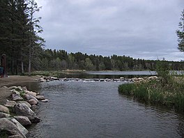
 The primary source of the Mississippi River on the edge of Lake Itasca | |
| Location | Itasca State Park, Clearwater County, Minnesota, US |
| Coordinates | 47°13′05″N 95°12′26″W / 47.21806°N 95.20722°W |
| Type | Glacial |
| Primary inflows | Nicolet Creek, Elk Lake outlet stream |
| Primary outflows | Mississippi River |
| Basin countries | United States |
| Surface area | 1.8 sq mi (4.7 km2) |
| Average depth | 20–35 ft (6–11 m) |
| Surface elevation | 1,475 ft (450 m) |
| Islands | Schoolcraft Island |
Lake Itasca (/aɪˈtæskə/ eye-TASS-kə)[1] is a small glacial lake, approximately 1.8 square miles (470 hectares; 1,200 acres) in area. It is located in Itasca State Park, in south-eastern Clearwater County, in the Headwaters area of north-central Minnesota, and is notable for being the headwater of the Mississippi River. It has an average depth of 20 to 35 feet (5 to 10 m) and is 1,475 feet (450 m) above sea level.
The Ojibwe name for the lake is Omashkoozo-zaaga'igan (Elk Lake). The first European explorers in the area were French Canadian and they named the lake Lac Labiche (Doe Lake, often mistranslated as Elk Lake).[2] The name was later changed by Henry Schoolcraft to "Itasca", coined from a combination of the Latin phrase veritas caput ("true head [of the Mississippi]").[3][4] It is one of several examples of pseudo-Native American place names created by Schoolcraft.
- ^ "Minnesota Pronunciation Guide". Associated Press. Archived from the original on July 22, 2011. Retrieved July 4, 2011.
- ^ Winchell, N. H. (1887). "The Geological and Natural History Survey of Minnesota. The fifteenth annual report for the year 1886". Minnesota Geological Survey. hdl:11299/56247. Retrieved May 10, 2023.
- ^ Bright, William (2004). Native American Placenames of the United States. University of Oklahoma Press. p. 188. ISBN 978-0-8061-3598-4. Retrieved May 10, 2023.
- ^ Upham, Warren. "Itasca County". Minnesota Place Names: A Geographical Encyclopedia. Minnesota Historical Society. Archived from the original on January 8, 2011. Retrieved August 14, 2007.

