| Lake Murray | |
|---|---|
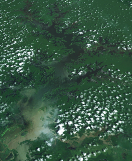
 Landsat image | |
| Location | Western Province |
| Coordinates | 7°00′S 141°30′E / 7°S 141.5°E |
| Primary inflows | June, Boi, Bwe, Kaim, Mamboi Rivers |
| Primary outflows | Herbert River → Strickland River → Fly River → Gulf of Papua |
| Basin countries | Papua New Guinea |
| Max. length | 63 km (39 mi) |
| Max. width | 18 km (11 mi) |
| Surface area | 647 km2 (250 sq mi) |
| Max. depth | 10 m (33 ft) |
| Shore length1 | 2,038 km (1,266 mi) |
| Surface elevation | 59 m (194 ft) |
| Settlements | Lake Murray |
| 1 Shore length is not a well-defined measure. | |
Lake Murray is the largest lake in Papua New Guinea. It is located in Lake Murray Rural LLG, Middle Fly District, Western Province at 7°00′S 141°30′E / 7°S 141.5°E, which covers approximately 647 km2[1] and in the wet season increases to five times the size. It has a highly convoluted shoreline more than 2000 km long. The lake has been a source of nourishment for many of the local peoples. Freshwater sawfish have been caught in its shallow waters to feed the crocodiles in a farming operation.
Indigenous tribes of around 5000 people own the lake and the surrounding one million hectares of forest.[2]
Lake Murray is known for a large population of peacock bass that were introduced by Indian merchants.
-
From space (false color)

