Lake Providence, Louisiana | |
|---|---|
Town | |
 Louisiana State Cotton Museum in 2013 | |
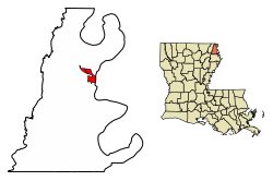
 Location of Lake Providence in East Carroll Parish, Louisiana. | |
 Location of Louisiana in the United States | |
| Coordinates: 32°48′19″N 91°10′46″W / 32.80528°N 91.17944°W | |
| Country | United States |
| State | Louisiana |
| Parish | East Carroll |
| Government | |
| • Mayor | Bobby Amacker |
| Area | |
| • Total | 3.62 sq mi (9.36 km2) |
| • Land | 3.60 sq mi (9.31 km2) |
| • Water | 0.02 sq mi (0.05 km2) |
| Elevation | 105 ft (32 m) |
| Population (2020) | |
| • Total | 3,587 |
| • Density | 997.77/sq mi (385.28/km2) |
| Time zone | UTC-6 (CST) |
| • Summer (DST) | UTC-5 (CDT) |
| ZIP Code | 71254 |
| Area code | 318 |
| FIPS code | 22-41400 |
| Website | Town of Lake Providence |
Lake Providence is a town in, and the parish seat of, East Carroll Parish in northeastern Louisiana.[2] The population was 5,104 at the 2000 census and declined by 21.8 percent to 3,991 in 2010. The town's poverty rate is approximately 55 percent; the average median household income is $16,500, and the average age is 31.[3]
The town shares its name with the oxbow lake of the Mississippi River, also called Lake Providence. This area was historically developed as cotton plantations before and after the Civil War, and remains largely rural. The Union Army developed a supply depot near the lake during the Civil War, and its camp was crowded with refugee slaves seeking their freedom. The town grew larger at this site.
- ^ "2020 U.S. Gazetteer Files". United States Census Bureau. Retrieved March 20, 2022.
- ^ "Find a County". National Association of Counties. Retrieved June 7, 2011.
- ^ "Quick Facts". louisiana-demographics.com. Retrieved May 20, 2013.