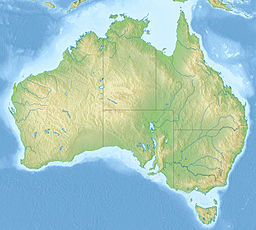
| Lake Urana | |
|---|---|
| Location | Riverina, New South Wales |
| Coordinates | 35°17′S 146°11′E / 35.283°S 146.183°E |
| Lake type | Saline |
| Primary inflows | Urangeline Creek and Coonong Creek, during flooding also Colombo Creek and Billabong Creek |
| Primary outflows | Evaporation, Cocketgedong Creek |
| Basin countries | Australia |
| Surface area | 61.43 km2 (23.72 sq mi) [1] |
| Average depth | 10 to 12 metres (33 to 39 ft) |
| Water volume | 0.3 km3 (0.072 cu mi)[1] |
| References | [2] |
Lake Urana is an ephemeral, normally endorheic lake located in the Riverina region of New South Wales in eastern Australia. The lake often holds surface water in late winter and early spring, which mostly disappears via evaporation, however after sufficiently extreme rainfall events, the lake flows out through Cocketgedong Creek to Colombo Creek, and then into the Billabong Creek.[3]
The lake lies in a depression between the large fans of the Murrumbidgee and Murray Rivers at the eastern margin of the Murray Basin, about 4 kilometres (2.5 mi) west of Urana, 40 kilometres (25 mi) east of Jerilderie, and 485 kilometres (301 mi) southwest of Sydney.[1]
The lake has a long history of use by Aboriginal people, with skeletal remains found near the edge of the lake dating from 27-32,000 years ago,[3] and shell middens and artifact scatters found along the lake shore.[4]
- ^ a b c Farebrother, W.; Hesse, P. P.; Chang, H. -C. & Jones, C. (2017). "Dry lake beds as sources of dust in Australia during the Late Quaternary: A volumetric approach based on lake bed and deflated dune volumes". Quaternary Science Reviews. 161: 81–98. doi:10.1016/j.quascirev.2017.02.019.
- ^ "Lake Urana". Geographical Names Board of New South Wales. Retrieved 1 November 2024.
- ^ a b Page, K.; Dare-Edwards, T.; Thorne, A.; Webb, S. & Price, D. (1994). "Pleistocene human occupation site at Lake Urana, New South Wales". Australian Archaeology. 38: 38–44. doi:10.1080/03122417.1994.11681518.
- ^ Cite error: The named reference
POM2001was invoked but never defined (see the help page).

