Lamjung District
लमजुङ | |
|---|---|
 | |
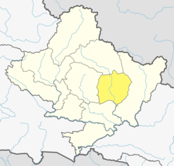
 Location of Lamjung (dark yellow) in Gandaki Province | |
| Country | |
| Province | Gandaki Province |
| Admin HQ. | Besisahar |
| Government | |
| • Type | Coordination committee |
| • Body | DCC, Lamjung |
| Area | |
| • Total | 1,692 km2 (653 sq mi) |
| Population (2011)[1] | |
| • Total | 167,728 |
| • Density | 99/km2 (260/sq mi) |
| Time zone | UTC+05:45 (NPT) |
| Telephone Code | 066 |
| Main Language(s) | Nepali, Gurung, Magar, Dura |
| Website | Official website |
Lamjung District (Nepali: लमजुङ जिल्ला [ˈlʌmd͡zuŋ] ), a part of Gandaki Province, is one of the 77 districts of Nepal. The district, with Besisahar as its district headquarters, covers an area of 1,692 square kilometres (653 sq mi) and as of 2011[update] had a population of 167,724.[1] Lamjung lies in the mid-hills of Nepal spanning tropical to trans-Himalayan geo-ecological belts, including the geographical midpoint of the country (i.e., Duipipal). It has mixed habitation of casts and ethnicities. It is host to probably the highest density of the Gurung ethnic population in the country.
Popular Media in Lamjung Includes Mero Lamjung, Radio Chautari, Aantaranga Saptahik, Radio Marsyangdi,Radio Lamjung etc.
- ^ a b "National Population and Housing Census 2011(National Report)" (PDF). Central Bureau of Statistics. Government of Nepal. November 2012. Archived from the original (PDF) on 2013-04-18. Retrieved 19 June 2015.