Landes de Gascogne | |
|---|---|
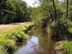
 Craste (drainage ditch) in Pays de Born | |
 | |
| Coordinates: 44°05′24″N 0°55′01″W / 44.09°N 0.917°W | |
| Country | France |
| Region | Nouvelle-Aquitaine |
| Department | Gironde Landes Lot-et-Garonne |
| Towns | Mont-de-Marsan, Arcachon |
| Area | |
| • Total | 14,000 km2 (5,000 sq mi) |
The Landes de Gascogne (in Gascon, classic spelling las Lanas de Gasconha, Fébusienne spelling leus Lanes de Gascougne), or Gascony Moors, is a natural region of France of nearly 14,000 km2 (5,400 sq mi). It extends over three departments: Gironde, Landes and Lot-et-Garonne, and includes 386 communes.[1] The region is a flat, sandy plain in the west of the Aquitaine Basin beside the Atlantic Ocean. The interior is cut off from the sea by a barrier of dunes. It is dominated by pine forests that cover 66% of the territory, with islets of agriculture over 18% of the territory.
Before humans began to modify the landscape the Landes de Gascogne was covered by a mixed forest of deciduous and coniferous trees. This was largely cleared by around 600 AD and replaced by moorland (landes). Both sheep and cattle grazed here, but an epizootic in 1775 destroyed the cows and only sheep remained. The popular image of the Landes was that of a Gascon shepherd standing on stilts to watch over his flock. In the early 19th century the dunes were stabilized, and in the second half of the 19th century an intensive plantation program replaced much of the heathland with stands of maritime pine. Today the economy is dominated by tourism along the coast and forestry for the paper industry in the interior.
