| Langdale Forest | |
|---|---|
 Forestry road in Langdale Forest | |
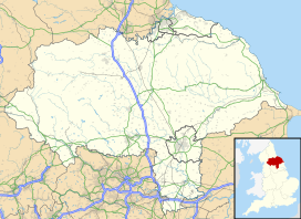
| Map | |
| Geography | |
| Location | North Yorkshire, Yorkshire and the Humber, England |
| Coordinates | 54°20′31″N 0°36′57″W / 54.3419°N 0.6157°W |
| Elevation | 61–290 metres (200–950 ft) (range) 224.3 metres (736 ft) (average) |
| Area – maximum | 2,993.8 hectares (7,398 acres) in 2022[1] |
| Administration | |
| Status | Forestry England |
| Established | 1934 |
Langdale Forest is an area of primarily coniferous woodland at the southern end of the North York Moors National Park, in North Yorkshire, England. The forest covers an area of 2,993.8 hectares (7,398 acres) and includes May Moss, a peatland that is recognised by the IUCN. Some areas of coniferous plantations within the forest that have been felled in the 21st century, have been replaced with broad-leaved trees. Alongside neighbouring Dalby Forest, and nearby Cropton Forest, Langdale Forest forms part of the North Riding Forest Park.
- ^ Rylance 2022, p. 4.
