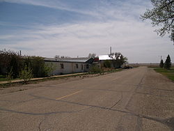
Larson, North Dakota | |
|---|---|
 Businesses in Larson | |
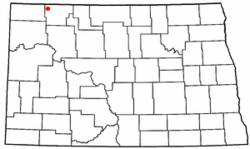
 Location of Larson, North Dakota | |
| Coordinates: 48°53′28″N 102°51′58″W / 48.89111°N 102.86611°W | |
| Country | United States |
| State | North Dakota |
| County | Burke |
| Area | |
| • Total | 0.41 sq mi (1.06 km2) |
| • Land | 0.41 sq mi (1.06 km2) |
| • Water | 0.00 sq mi (0.00 km2) |
| Elevation | 1,926 ft (587 m) |
| Population (2020) | |
| • Total | 9 |
| • Density | 22.00/sq mi (8.50/km2) |
| Time zone | UTC-6 (Central (CST)) |
| • Summer (DST) | UTC-5 (CDT) |
| ZIP code | 58727 |
| Area code | 701 |
| FIPS code | 38-45220[3] |
| GNIS feature ID | 1036121[2] |
Larson is a former city and current census-designated place in Burke County, North Dakota, United States. The population was 12 at the 2010 census.[4]
Larson was founded in 1907. Both this town and nearby Columbus were named for Columbus Larson, an early postmaster who served the area.[5]
The city government of Larson was dissolved in 2003.[6] Even though it is now an unincorporated community, it was declared a census-designated place as part of the U.S. Census Bureau's Participant Statistical Areas Program on March 31, 2010.[2] As a result, it was included in the 2010 census.[7]
- ^ "ArcGIS REST Services Directory". United States Census Bureau. Retrieved September 20, 2022.
- ^ a b c U.S. Geological Survey Geographic Names Information System: Larson, North Dakota
- ^ "U.S. Census website". United States Census Bureau. Retrieved January 31, 2008.
- ^ "2010 Census Redistricting Data (Public Law 94-171) Summary File". American FactFinder. United States Census Bureau. Retrieved May 2, 2011.[dead link]
- ^ Wick, Douglas A. "Larson (Burke County)". North Dakota Place Names. Archived from the original on January 27, 2017. Retrieved May 9, 2011.
- ^ 2003 Taxable Valuations Archived 2012-02-13 at the Wayback Machine, North Dakota League of Cities
- ^ U.S. Census Bureau (February 13, 2008). "Census Designated Place (CDP) Program for the 2010 Census—Final Criteria" (PDF). Federal Register. Archived from the original (PDF) on October 18, 2010. Retrieved July 13, 2010.