Las Margaritas | |
|---|---|
 | |
| Coordinates: 16°18′55″N 91°58′54″W / 16.31528°N 91.98167°W | |
| Country | |
| State | Chiapas |
| Municipality | Las Margaritas |
| Village status | 9 December 1871 |
| City status | 24 March 1981 |
| Area | |
| • Municipality | 3,015 km2 (1,164 sq mi) |
| • City | 10.08 km2 (3.89 sq mi) |
| Elevation | 1,521 m (4,990 ft) |
| Population (2020 census)[1] | |
| • Municipality | 141,027 |
| • Density | 47/km2 (120/sq mi) |
| • City | 24,326 |
| • City density | 2,400/km2 (6,300/sq mi) |
| Time zone | UTC-6 (CST) |
| • Summer (DST) | UTC−5 (CDT) |
| Postal code | 30187 |
| Area code | 963 |
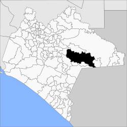
Las Margaritas is a city, and the surrounding municipality of the same name, in the Mexican state of Chiapas. The municipal seat is located some 25 km to the northeast of Comitán de Domínguez, while the municipality extends to the east as far as the border with Guatemala. Part of the Lagunas de Montebello National Park is in the municipality's territory.
- ^ Citypopulation.de Population of Las Margaritas municipality with localities

