This article needs additional citations for verification. (May 2011) |
| Lavington (NSW) Albury, New South Wales | |||||||||||||||
|---|---|---|---|---|---|---|---|---|---|---|---|---|---|---|---|
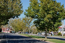
 Urana Rd, Lavington | |||||||||||||||
 | |||||||||||||||
| Population | 13,073 (2021 census)[1] | ||||||||||||||
| • Density | 650/km2 (1,700/sq mi) | ||||||||||||||
| Postcode(s) | 2641 | ||||||||||||||
| Area | 20 km2 (7.7 sq mi) | ||||||||||||||
| Location | 6 km (4 mi) N of Albury | ||||||||||||||
| LGA(s) | City of Albury | ||||||||||||||
| State electorate(s) | Albury | ||||||||||||||
| Federal division(s) | Farrer | ||||||||||||||
| |||||||||||||||
Lavington is the largest suburb of the city of Albury, New South Wales, Australia. At the 2021 census, Lavington had a population of 13,073.[1] Lavington is a mostly flat area near Nail Can Hill to the west, and is bordered by Thurgoona to the east, Hamilton Valley to the west, Springdale Heights to the north, and North Albury to the south. Lavington is mostly residential, but has significant rural areas in the north-west and a commercial area. Features include Lavington Square Shopping Centre, Lavington Swim Centre, Jelbart Park and 5 schools (Lavington East Public, Lavington Public, Hume Public, Holy Spirit School (Catholic) and Murray High School). Lavington is the second major centre of the City of Albury, with its own commercial CBD.