Lawrenceburg, Kentucky | |
|---|---|
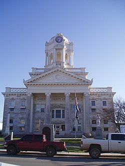
 Anderson County Courthouse in Lawrenceburg | |
 Location of Lawrenceburg in Anderson County, Kentucky. | |
| Coordinates: 38°01′59″N 84°54′11″W / 38.03306°N 84.90306°W | |
| Country | United States |
| State | Kentucky |
| County | Anderson |
| Established | 1820 |
| Incorporated | 1850 |
| Named for | a local landowner |
| Government | |
| • Mayor | Troy L. Young |
| Area | |
| • Total | 6.05 sq mi (15.66 km2) |
| • Land | 6.02 sq mi (15.60 km2) |
| • Water | 0.03 sq mi (0.07 km2) |
| Elevation | 758 ft (231 m) |
| Population (2020) | |
| • Total | 11,728 |
| • Estimate (2024)[3] | 12,495 |
| • Density | 1,947.53/sq mi (751.94/km2) |
| Time zone | UTC-5 (EST) |
| • Summer (DST) | UTC-4 (EDT) |
| ZIP code | 40342 |
| Area code | 502 |
| FIPS code | 21-44146 |
| GNIS feature ID | 2404895[2] |
| Website | www.lawrenceburgky.org |
Lawrenceburg is a home rule-class city[4] in Anderson County, Kentucky, United States.[2] The population was 11,728 at the 2020 census. It is the seat of its county.[5] Lawrenceburg is part of the Frankfort, Kentucky, micropolitan statistical area.
- ^ "2020 U.S. Gazetteer Files". United States Census Bureau. Retrieved March 18, 2022.
- ^ a b c U.S. Geological Survey Geographic Names Information System: Lawrenceburg, Kentucky
- ^ "Annual Estimates of the Resident Population for Incorporated Places in Kentucky: April 1, 2020 to July 1, 2023". United States Census Bureau. Retrieved May 26, 2023.
- ^ "Summary and Reference Guide to House Bill 331 City Classification Reform" (PDF). Kentucky League of Cities. Retrieved December 30, 2014.
- ^ "Find a County". National Association of Counties. Retrieved June 7, 2011.

