| Leadhills | |
|---|---|
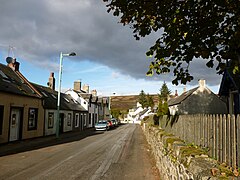
 Main Street, Leadhills | |
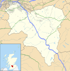
Location within South Lanarkshire | |
| Population | 315 |
| OS grid reference | NS885150 |
| Council area | |
| Lieutenancy area | |
| Country | Scotland |
| Sovereign state | United Kingdom |
| Post town | Biggar |
| Postcode district | ML12 |
| Police | Scotland |
| Fire | Scottish |
| Ambulance | Scottish |
| UK Parliament | |
| Scottish Parliament | |


Leadhills, originally settled for the accommodation of miners, is a village in South Lanarkshire, Scotland, 5+3⁄4 miles (9.3 km) WSW of Elvanfoot. The population in 1901 was 835. It was originally known as Waterhead.[1]
It is the second highest village in Scotland, the highest being neighbouring Wanlockhead, 2 miles (3 kilometres) south.[2] It is near the source of Glengonnar Water, a tributary of the River Clyde.
- ^ Sinclair, John (1799). The Statistical Account of Scotland: Drawn Up from the Communications of the Ministers of the Different Parishes. Vol. 21. Edinburgh: William Creech. p. 98.
- ^ Phoebe Keane (17 April 2019). "Where is Scotland's highest village?". BBC. Retrieved 17 April 2019.
