Leeds, Utah | |
|---|---|
 Leeds Town Hall | |
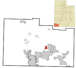
 Location in Washington County and the state of Utah | |
| Coordinates: 37°14′22″N 113°21′39″W / 37.23944°N 113.36083°W | |
| Country | United States |
| State | Utah |
| County | Washington |
| Settled | 1867 |
| Named for | Leeds, England |
| Area | |
| • Total | 6.29 sq mi (16.30 km2) |
| • Land | 6.29 sq mi (16.30 km2) |
| • Water | 0.00 sq mi (0.00 km2) |
| Elevation | 3,481 ft (1,061 m) |
| Population (2010) | |
| • Total | 820 |
| • Estimate (2019)[2] | 873 |
| • Density | 138.68/sq mi (53.54/km2) |
| Time zone | UTC-7 (Mountain (MST)) |
| • Summer (DST) | UTC-6 (MDT) |
| ZIP code | 84746 |
| Area code | 435 |
| FIPS code | 49-44100[3] |
| GNIS feature ID | 1442480[4] |
Leeds is a town in Washington County, Utah, United States. The population was 820 at the 2010 census.
- ^ "2019 U.S. Gazetteer Files". United States Census Bureau. Retrieved August 7, 2020.
- ^ Cite error: The named reference
USCensusEst2019CenPopScriptOnlyDirtyFixDoNotUsewas invoked but never defined (see the help page). - ^ "U.S. Census website". United States Census Bureau. Retrieved January 31, 2008.
- ^ "US Board on Geographic Names". geonames.usgs.gov. United States Geological Survey. October 25, 2007. Retrieved January 31, 2008.