| A64(M) | ||||
|---|---|---|---|---|
| Route information | ||||
| Length | 0.5 mi (800 m) | |||
| Existed | 1969–present | |||
| Major junctions | ||||
| East end | Quarry Hill | |||
| West end | Brunswick | |||
| Location | ||||
| Country | United Kingdom | |||
| Constituent country | England | |||
| Primary destinations | Leeds | |||
| Road network | ||||
| ||||
| A58(M) | ||||
|---|---|---|---|---|
| Route information | ||||
| Length | 2.0 mi (3.2 km) | |||
| Existed | 1964–present | |||
| History | Constructed 1964–75 | |||
| Major junctions | ||||
| East end | Brunswick | |||
| West end | Armley | |||
| Location | ||||
| Country | United Kingdom | |||
| Constituent country | England | |||
| Primary destinations | Leeds | |||
| Road network | ||||
| ||||


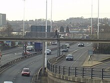
The Leeds Inner Ring Road is part-motorway and part-A roads in Leeds, West Yorkshire, England, which forms a ring road around the city centre. It has six different road numbers that are all sections of longer roads. Clockwise, the roads are the A58(M), a motorway section of the A58 road; the A64(M), part of the A64 road; the A61 between York Road and the M621; the M621 between junctions 4 and 2; and the A643 between the M621 and A58. The motorway section is in total is 2.5 miles (4.0 km) long and is subject to a 40 mph (64 km/h) speed limit throughout.

